

Multi Beam Echo Sounder
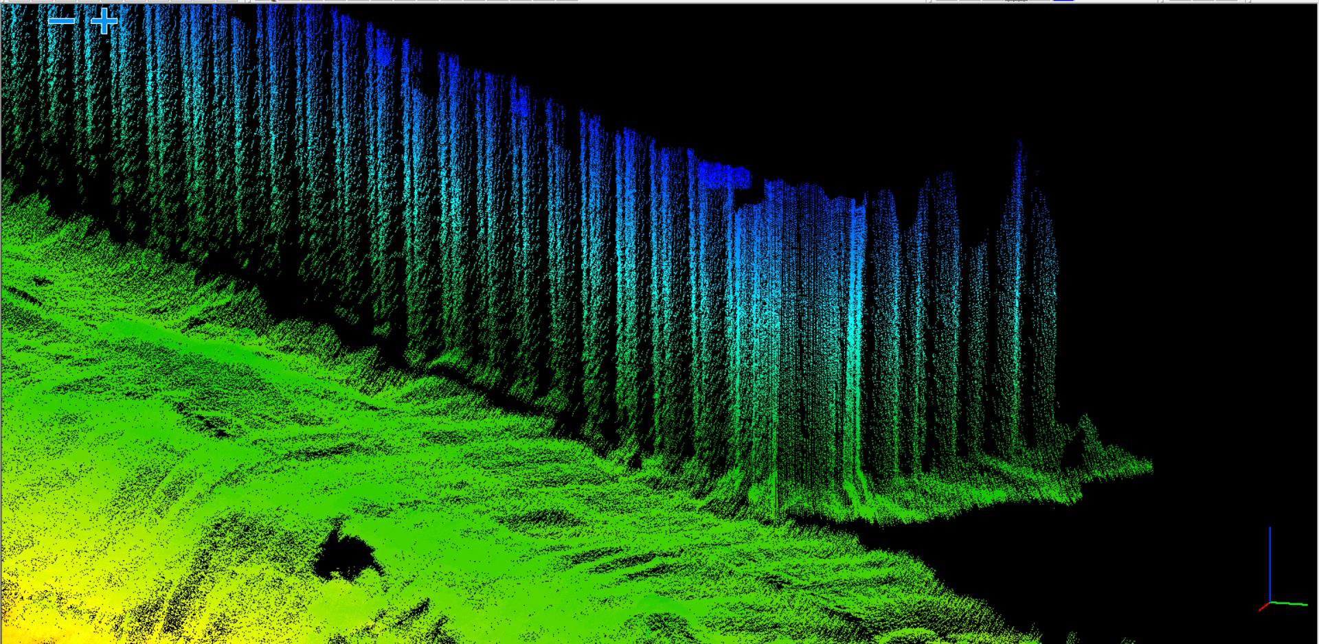
As with many fields of geomatics today clients are looking for more information in order to build a more complete picture of the under sea environment so that they can make better informed decisions based upon real survey data covering 100 % of the sea floor and not just the track line that the boat has passed over as is the case with SBES. MBES offers a more complete richer data set so that a 3D world can be envisaged. In recent time MBES are being utilised in structural scour surveys of bridges, quay walls, wind farm monopiles, cable routes and areas experiencing erosion as a result of mechanical factors-propellers and jet drives form large ships as the structure and surrounding marine bed can be surveyed and modelled in high definition 3D which facilitates better decision making, less interpretation and better monitoring/comparison in the future. In addition Side Scan Sonar can also aid interpretation of the sea bed and its environs as debris can be identified and located- old bridge piles, timber posts, debris and historical repairs.
Capability
HHS has the ability to undertake MBES for numerous applications and locations having gained considerable/extensive experience in successfully undertaking surveys abroad. The data can either stand alone as a deliverable or can be united with third party data sets to offer a complete environment data set. Surveys are carried out to the highest order and in many cases are only one element of the overall tender as Side Scan Sonar and Sub Bottom Profiler can also be utilised as can laser scanning. Typically a vessel would be setup and calibrated with a full survey suite of hardware and software to cover all scenarios.
Service
MBES can be utilised in the same operational requirements as SBES, but normally the sea/river bed has 100 % insonification, this allows a higher level of accuracy, less interpretation of data and more realistic modelling. Data is of a higher order of accuracy as it is normally corrected for velocity (SVP), timing, heave pitch & roll, heading and RTK for height.

Monitoring
Regular depth monitoring surveys in historical problematic areas known to silt up
River flood surveys
Water abstraction
Pipe outfall routes
Reservoir surveys

Marine developments, ports, marinas, shipping channels
Settlement ponds
XYZ data to facilitate hydrodynamic model generation
Cable routes
Wind farms
Scour surveys
Delivery formats
xyz, tin, contours, maps, kmz, ascii, volumes, diff models, dxf, dwg